Moffitts Antiques
Antique Engraved Sea Chart England Scotland & Ireland Hand Coloured Framed Map
Antique Engraved Sea Chart England Scotland & Ireland Hand Coloured Framed Map
Couldn't load pickup availability
A genuine antique engraved sea chart of the British Isles, titled 'A New & Correct Chart of England, Scotland & Ireland', engraved with rhumb lines, compass roses and a decorative title cartouche bearing the royal arms.
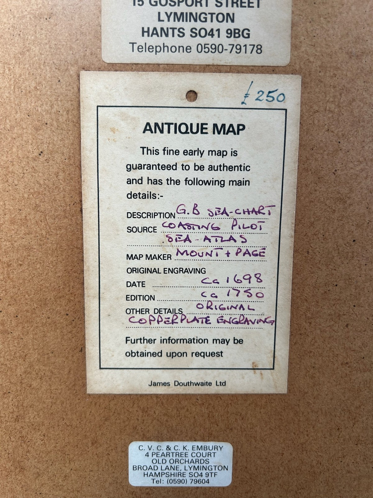
The chart derives from Mount & Page's 'The English Pilot', the long-running English sea atlas published in numerous editions through the mid 18th century. It is a working sea chart of its day, oriented with west to the top in the manner of the period.
The chart is hand-coloured and presented framed and glazed, overall approximately 77 x 67 cm. It carries a Gosport Gallery (Lymington) provenance label to the reverse.
Please note that the hand-colouring on charts of this kind is typically later decorative colouring rather than original publisher's colour, as was common practice.
Condition: a genuine period chart in good condition. The information on the reverse label is correct. Please examine the photographs closely as they form part of the description.
Dispatch: carefully packed and posted with tracking. UK and international postage available. Please see photographs as part of the description and message with any questions before buying.