Moffitts Antiques
Saxton Kip Merioneth Antique Map Camden Britannia 17th Century Coloured Framed
Saxton Kip Merioneth Antique Map Camden Britannia 17th Century Coloured Framed
Couldn't load pickup availability
An early 17th-century copper-engraved map of Merioneth after Christopher Saxton, engraved by William Kip for William Camden's Britannia. Signed in the plate "Chr: Saxton descrip:" and "W. Kip sculp:", with the title cartouche MERIONITH Comitatus olim pars ORDOVICUM.
Camden's Britannia was first published in 1586 with only a general map; the 1607 edition was the first to include a full set of county maps, engraved by William Kip and William Hole from the surveys of Saxton and Norden. These maps were reissued in the English editions that followed. This example has a decorative strapwork title cartouche, a scale of miles and a compass rose in the Irish Sea, with Harlech on the coast.
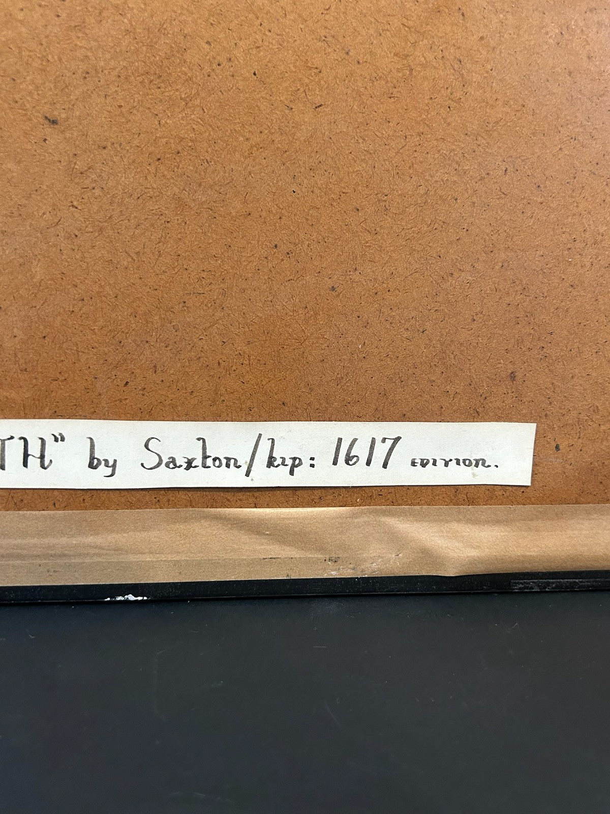
A label to the reverse describes it as "'Merioneth' by Saxton/Kip: 1617 edition"; as the verso has not been examined it is offered as from Camden's Britannia, early 17th century.
Size: 45 x 40 cm framed. With hand colouring, in a green mount and gilt-edged frame.
Condition: toning to the sheet consistent with age.
PLEASE READ - the photographs form part of the description. This is a genuine antique several centuries old and it shows its age. Please examine every photograph carefully and make sure you are completely happy with the condition before you buy. The map has not been removed from its frame, so the reverse of the sheet, any text on the verso and any margins hidden by the frame have not been inspected. Hand colouring on antique maps may be original or later. Toning, foxing, spotting, staining, creases and old repairs should all be expected on an item of this age, and anything not visible in the photographs cannot be guaranteed. Dimensions are approximate. If you have any questions or would like more photographs, please ask before purchasing.
Carefully packed and posted.